

Ask UK Holiday Breaks
Tell us where you're going, who you're travelling with, or what you'd like to do.
Bwlch Nant yr Arian – near Aberystwyth
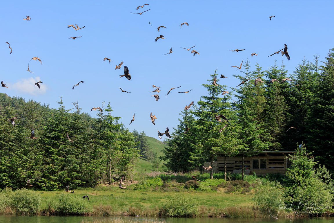
You should visit Bwlch Nant yr Arian to watch red kites sweep down over a forest lake in one of Mid Wales’s most memorable wildlife displays. The birds circle above the trees before diving towards the feeding area, often passing close enough for you to see their forked tails and changing wing movements.
There is much more here than birdwatching. You can follow accessible lakeside paths, climb onto open ridges, try waymarked mountain-bike trails, practise riding skills, enjoy family play areas or simply stop for a peaceful walk in the Cambrian Mountains.
Why You Should Visit
Bwlch Nant yr Arian works equally well as a wildlife visit, family outing or active day in the forest. You can arrive shortly before the kite feeding and stay for an hour, or spend most of the day walking, cycling and exploring.
The mixture of lake, forest and exposed hillside means the scenery changes quickly. Some routes stay close to the main visitor area, while others climb high enough to reveal views towards Cardigan Bay and the Cambrian Mountains.
Watch the Red-Kite Feeding
The daily red-kite feeding is the experience you should not miss. The birds begin gathering above the trees and lake before swooping towards the food, twisting and turning in the air as they compete for each piece.
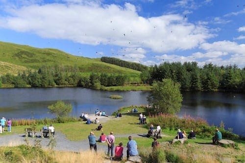
Follow the easy Barcud Trail around the lake to the viewing area. You can also continue to the large bird hide for a closer view of the birds coming down to feed.
Arrive in good time rather than walking towards the hide at the last moment. The gathering birds and gradual build-up are part of the experience.
Recognise a Red Kite
Red kites are large birds of prey with long angled wings, reddish-brown bodies and deeply forked tails. Their tails constantly twist as they steer, making them easy to distinguish from buzzards once you know what to look for.
Watch how they collect food without landing. A kite may drop towards the ground, snatch a piece with its feet and then eat while flying away.
Children can count how many birds they see or compare the shapes of kites, buzzards, ravens and crows around the feeding area.
Follow the Barcud Trail
The Barcud Trail is the easiest way to explore the lake and reach the main kite-watching areas. The circular route is suitable for wheelchairs and pushchairs and includes resting places on uphill sections.
Along the way, look for information about red kites, animal sculptures, poetry and stories connected with local folklore and mining history.
An Animal Puzzle Trail follows the same route, giving families something extra to search for as they walk.
Take the Miners’ Trail
The Miners’ Trail gives you a more energetic walk through the landscape. It follows well-defined paths but includes longer climbs, descents and sections that may be rough, wet or exposed.
The route passes an old mining leat before climbing towards the ridgetop. Stop at the Giant’s Chair to rest and enjoy the view.
This is a good choice when you want more than the lakeside circuit without committing to the longest walking route.
Climb the Ridgetop Trail
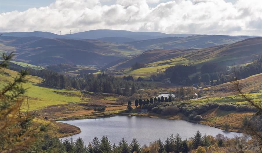
The Ridgetop Trail takes you onto higher, more exposed ground where the landscape opens towards Cardigan Bay and the Cambrian Mountains.
The route includes sustained climbs and descents, so allow more time than the distance alone might suggest. Wind, rain and mist can also make the exposed sections feel much harder.
On a clear day, the high viewpoints are worth the effort. Pause regularly and look back because some of the best scenery appears behind you as you climb.
Bring Your Mountain Bike
Bwlch Nant yr Arian is one of the most important mountain-bike destinations in Mid Wales. Its waymarked routes range from a family-friendly forest-road ride to demanding red and black trails across remote, exposed countryside.
Choose your route honestly according to your fitness and technical ability. Trail grades describe the difficulty, but weather, mud, forestry work and fatigue can make a familiar grade feel harder.
Read the information panel before setting out and check for closures or diversions. Several trail users may share parts of the forest, so expect to meet walkers, runners, horse riders and other cyclists.
Try the Arian Trail
The Arian Trail is the gentlest mountain-bike option and is suitable for families who are comfortable riding on forest roads.
There are no singletrack sections, although the route includes a public-road section around the lake and a short climb on the return.
It is a useful first ride for visitors who want forest scenery without immediately attempting a technical mountain-bike trail.
Build Confidence on the Melindwr Trail
The blue-grade Melindwr Trail is designed to help riders progress before moving onto more difficult routes.
Its flowing descents include berms and rollers, with shorter and longer loop options available. Riders should already be confident on blue-grade terrain before attempting it.
The trail gives developing riders a chance to practise control, cornering and maintaining momentum on purpose-built features.
Tackle the Red and Black Trails
Experienced riders can choose the red-grade Pendam and Summit trails or the much longer black-grade Syfydrin route.
These rides include flowing singletrack, climbs, remote moorland and exposed terrain. The longest route reaches far beyond the immediate visitor area and requires preparation, suitable equipment and confidence in changing conditions.
Do not attempt a difficult route simply because others in the car park are riding it. A shorter trail completed safely is far more enjoyable than becoming exhausted or stranded in remote countryside.
Practise in Parc Sgiliau
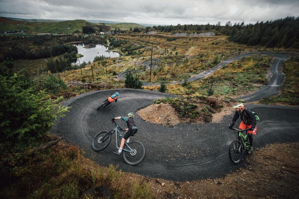
Parc Sgiliau is a purpose-built skills park where mountain bikers can practise before setting out on the longer trails.
Features include rollers, berms, step-ups, tabletops, hips and bowls. Riders can repeat sections and build confidence without committing to a full forest route.
Wear a helmet and inspect features before riding them. Allow space between riders and do not stop in landing areas or on blind sections.
Enjoy Trail Running
Waymarked running routes also begin from the main car park. They combine forest roads and singletrack with mud, roots, rocks and exposed ridge sections.
The shorter Y Llo route provides an introduction to trail running, while Y Fuwch adds more distance, climbing and varied terrain.
Proper trail footwear is important because surfaces can become slippery after rain.
Try Orienteering
Four permanent orienteering courses allow visitors to test their map-reading and navigation skills.
Courses range from beginner-friendly options to more difficult challenges. Download the relevant map before arriving or save it to your device in case mobile coverage is poor.
Orienteering is a useful family activity when you want more purpose than a straightforward walk but do not have bikes or specialist equipment.
Let Children Play
There are two timber play areas, with separate equipment for younger and older children.
The play areas are useful before or after the kite feeding, particularly when children need a more active break from waiting and watching.
Combine the play area with the Animal Puzzle Trail and lakeside walk for a family visit that does not require a demanding climb.
Choose Your Visit
Red-Kite Visit
Follow the Barcud Trail, watch the daily feeding and spend time in the hide beside the lake.
Family Forest Day
Combine the accessible trail, animal puzzle, kite feeding and timber play areas.
Walking Adventure
Choose the Miners’ or Ridgetop Trail for steeper paths, open views and a more energetic visit.
Mountain-Bike Day
Warm up in the skills park and select a waymarked route suited to your experience and fitness.
Make the Most of Your Visit
Allow at least two hours for the Barcud Trail, kite feeding and a relaxed family visit. Walkers and mountain bikers should allow considerably longer according to their chosen route.
Plan the day around the feeding time if the red kites are your priority. Complete a shorter activity beforehand rather than beginning a long trail and rushing back.
Check the official site before travelling because forestry work, maintenance and severe weather can temporarily close or divert trails.
Food and Drink
The original café and shop are currently closed. A separate unit in the car park normally provides hot drinks and cold food on most days, but opening can vary.
Bring water, snacks and enough food for your planned activity, particularly when cycling or walking on longer routes.
For a larger meal or more choice, continue towards Aberystwyth or stop in one of the nearby villages.
When the Weather Changes
The lakeside trail offers a relatively short outing in light rain, but the higher walking and cycling routes are much more exposed.
Snow, ice, high wind and forestry operations can cause closures at short notice. The approach road and car park may also become slippery in winter conditions.
Do not rely on the visitor building for shelter or staff assistance. The site is currently unstaffed, so arrive prepared for the weather and your chosen activity.
Useful Local Options
Ponterwyd has limited local facilities, so it is sensible to collect fuel, food and other supplies before travelling into the forest.
Aberystwyth, around nine miles to the west, provides restaurants, cafés, supermarkets, pharmacies, shops, a cinema and indoor leisure facilities.
When poor weather makes the higher trails unsuitable, you could combine a shorter kite visit with lunch, shopping or an indoor attraction in Aberystwyth.
Devil’s Bridge is another possible stop nearby, but its waterfall trails also involve steep outdoor routes and may not be suitable in severe weather.
Good to Know
- Bwlch Nant yr Arian is near Ponterwyd, approximately nine miles east of Aberystwyth, postcode SY23 3AB.
- The postcode covers a wide area, so follow the official directions and roadside signs from the A44.
- The forest and trails are open throughout the year unless weather, forestry work or maintenance causes a closure.
- Red kites are currently fed beside the lake every day at 2pm.
- There is no separate charge to watch the feeding.
- The visitor centre is currently unstaffed.
- The former café and shop are closed.
- A car-park unit normally sells hot drinks and cold food on most days.
- Portable toilets are open daily.
- Parking charges apply, using the current ticket-machine or RingGo arrangements.
- Automatic number-plate recognition is in operation, and payment must be made under the displayed terms.
- Overnight parking is prohibited.
- Blue Badge holders can park free but must register their vehicle under the current procedure.
- The Barcud Trail is suitable for wheelchairs and pushchairs, with no steps or stiles.
- Accessible toilets are available.
- Mountain-bike routes range from family forest roads to severe, remote trails.
- Dogs are welcome but must be kept on a lead or under close control.
- The X47 bus between Aberystwyth and Llanidloes can stop on request near the car-park entrance.
- Check current trail diversions and closures before travelling.
Who Will Enjoy Bwlch Nant yr Arian?
Bwlch Nant yr Arian is ideal for families, wildlife enthusiasts, walkers, runners, mountain bikers, photographers and visitors who want an outdoor attraction with several different levels of activity.
The accessible lakeside trail makes the kite feeding available to a broad range of visitors, while the longer walks and technical cycling routes provide genuine challenges for more active groups.
Stay near Bwlch Nant yr Arian: Find hotels, cottages and short-break accommodation for exploring Aberystwyth, the Cambrian Mountains and the Mid Wales coast.