

Ask UK Holiday Breaks
Tell us where you're going, who you're travelling with, or what you'd like to do.
Llyn Elsi Walk, Betws-y-Coed – Route & Visitor Guide
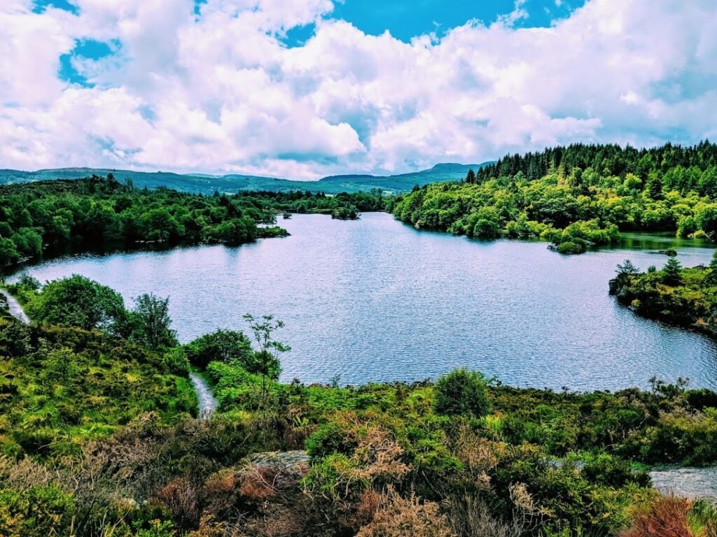
The Llyn Elsi Walk is one of the best-known walks from Betws-y-Coed, climbing through Gwydir Forest to a peaceful upland lake above the village. The route is scenic and rewarding, but the climb is steep enough for Natural Resources Wales to grade it as strenuous.
Llyn Elsi Walk at a Glance
- Best for: Walkers, couples, older families and nature lovers
- Start: Behind St Mary’s Church, Betws-y-Coed
- Distance: 3.9 miles / 6.2 km
- Time: Around 2–3 hours
- Ascent: Around 318 metres
- Difficulty: Strenuous
- Terrain: Forest roads and narrower uneven paths with mud, rocks and tree roots
- Cost: Free to walk; parking charges may apply in the village
What Is Llyn Elsi?
Llyn Elsi is a quiet lake in the hills above Betws-y-Coed, surrounded by forest and mountain scenery. Reaching it involves a steep climb from the village, which helps give the lake a much more peaceful atmosphere than the busy streets below.
The walk around the lake adds variety to the route, with changing views across the water and surrounding woodland.
The Walk from Betws-y-Coed
The official trail begins on the forest road behind St Mary’s Church in the centre of Betws-y-Coed. The route climbs steeply almost immediately, following forest roads and narrower paths higher into Gwydir Forest.
The initial ascent is the hardest part of the walk. There are benches and resting places along the way, so there is no need to rush the climb.
Walking Around Llyn Elsi
Once you reach the lake, the route follows the shoreline before eventually rejoining the main path back towards Betws-y-Coed.
The lake section is much gentler than the climb from the village and is the most peaceful part of the walk, with woodland, water views and several places to stop and rest.
How Difficult Is the Walk?
Natural Resources Wales grades the Llyn Elsi Walk as strenuous. Although it is not especially long, the route includes a substantial climb and sections of rough, uneven ground.
Expect mud, rocks and exposed tree roots, particularly after wet weather. Some paths are less than one metre wide.
Good walking footwear is strongly recommended.
Is It Suitable for Families?
The walk can suit active families with older children who are comfortable with a sustained uphill walk.
It is not suitable for pushchairs, and younger children may find the steep ascent tiring. Families wanting something easier around Betws-y-Coed may prefer one of the shorter riverside or forest walks in Gwydir Forest Park.
When Is the Best Time to Walk?
Spring through to autumn usually provides the easiest conditions, although the route can be walked year-round by experienced walkers with suitable clothing and footwear.
After prolonged rain, forest paths can become muddy and slippery. In poor visibility or severe weather, a lower-level walk may be a better choice.
Parking and Getting There
The trail starts behind St Mary’s Church in the centre of Betws-y-Coed. This is different from most of the other Gwydir Forest walking trails, which begin near Pont y Pair car park.
Public parking is available in Betws-y-Coed, including Pont y Pair car park, where charges apply.
The village also has a railway station and bus connections, so the walk can be reached without a car.
What to Take
- Walking boots or sturdy footwear
- Water and snacks
- Waterproof clothing
- Warm layers in cooler weather
- A route map or downloaded trail information
- A charged phone
Combine It with Betws-y-Coed
The walk starts and finishes in the village, so it is easy to combine with cafés, shops and other local attractions.
Visitors staying longer could also explore Swallow Falls, Gwydir Forest Park or the Conwy Valley Railway Museum.
Good to Know
- The route is officially graded strenuous.
- The steepest climbing is near the start from Betws-y-Coed.
- The trail is waymarked with white marker symbols.
- Paths can be muddy and uneven.
- There are benches on the ascent and around the lake.
- No booking is required.
- Check current trail conditions before setting out in poor weather.